I finally made it out for a SOTA activation yesterday--my first activation this year, I'm sorry to say.
I activated Santa Fe Mountain (W0C/FR-042) for SOTA and tried to get a dual POTA activation, but unfortunately I only got 8 QSOs which is enough for SOTA but 2 short for POTA. Oh, well....!
My friend Endre VA6BGE, who was visiting Denver from Calgary, joined me for the activation. I chose Santa Fe as I wanted to do a peak that was challenging but not crazy, and Santa Fe looked like a reasonable one to activate. While we were successful, it was definitely not easy!
We left my house in Littleton CO around 7am on a clear, sunny Sunday. The weather forecast was really good--highs at altitude around 55F, sunny, no rain/lightning forecast. Based on Walt W0CP's and George KX0R's great writeups, I was able to easily find the recommended parking spot at 39.70761,-105.4349, which is about 5 minutes off of I-70 exit 248 (Floyd Hill / Beaver Brook). As described by previous folks, you have to park on that road as there is no public parking on Pat Creek Road, so you have to walk in a short while before you find the Beaver Brook Watershed trailhead. Go around the gate and get ready for a challenging hike!
The hike starts out easily enough, going through a gorgeous meadow. We were there in the fall, about 10 days past the peak Aspen color, but there were still stands of trees with gorgeous yellow and red leaves.
After hiking through the meadow, we found ourselves on a quasi-4WD road which was an easy enough hike, although the grade definitely started going up...and up....and up. There is a natural gas pipeline that parallels much of the road.

Before long, the road narrows into a single track and becomes quite steep, along with loose rocks and soil, making the going a lot harder and slower. I would definitely recommend hiking poles and good boots as you need good traction. And if it's wet/raining/snow packed, you're definitely going to need spikes or snowshoes. It took us close to an hour to get past this section, stopping often to catch our breath.
Finally, the road widens out and levels off about 1/4 mile from the point where you'll need to leave the road and head to the summit.
The hike in to the summit is actually one of the easiest parts of the hike. By that point we had climbed most of the vertical distance, and it was only about another 15 minutes to the top. Other than downed timber, it was very easy. There isn't a marked path/trail but it's pretty easy to find...just keep going up and you'll find it. The summit is really just a pile of rocks and the view from the top is fairly limited due to the trees and much higher peaks in close proximity.
Route to the summit

View from the top
Endre VA6BGE and Mark K0EHR
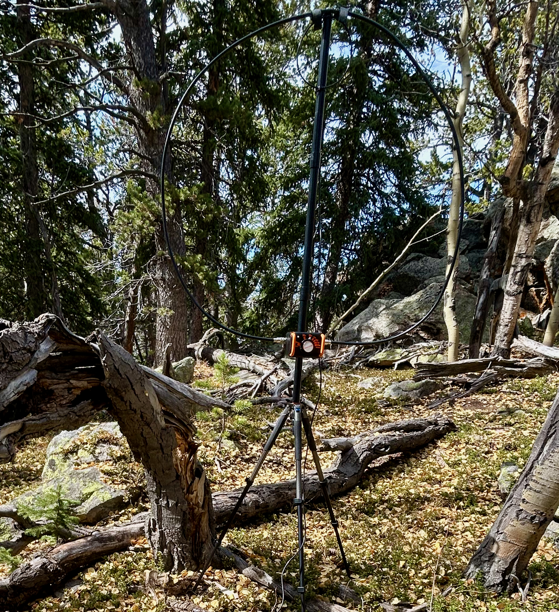
Once we made it to the top, we set up our equipment and started trying to get QSOs. I threw my 2 meter J-pole up in a tree and called CQ on the 2M calling frequency. Unfortunately, a guy down in Denver was using the frequency as his personal rag chew channel, and I wasn't able to get a single QSO, even after QSYing and spotting myself on the NA Adventure simplex frequency. In retrospect, I could have switchec over to one of the local repeaters and announced the activation, asking people to chase me on my simplex frequency. So I set up my magnetic loop antenna, connected my IC-705 to it, spotted myself using the SOTA Goat App (there is spotty cell coverage from the top, but virtually none once you drop below the summit), and I was off to the races. In the span of 16 minutes I had 8 SSB QSOs on 20 meters (including a summit-to-summit!), from all over the midwest and west (Oklahoma, Indiana, Kansas, Idaho, Washington, Colorado, and Washington state). Endre's setup was an IC-705 connected to an end-fed wire antenna and he used FT8 on several HF bands, with good luck. Conditions were great and the weather was fantastic, so we lingered on the summit for about an hour and then headed down.

My AlexLoop magnetic loop ready for action!
The descent was also tricky due to the steep grade, and it still took us over 2 hours to get back to the car. Overall time from leaving to the car until we got back to the car was 6 hours and 38 minutes; total distance hiked was 5.7 miles and vertical distance was 1,954 feet. I'm glad that we did the hike as it was fun and a definite challenge, but I'm not sure I'll do it more than once as it was a whole lot of work for just 6 points! And if you do try a dual SOTA/POTA activation, make sure you get at least 10 solid QSOs!


Comments
Post a Comment